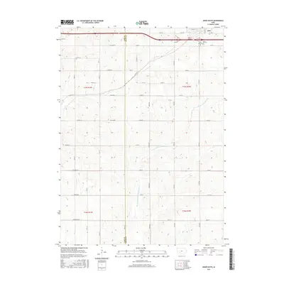
2015 Map of Adair South
USGS Topo · Published 2015About this map
The town of Adair sits at the northern edge of this 2015 survey, serving as a hub for the surrounding agricultural landscape where the Cass and Adair county lines meet. The terrain is defined by the winding paths of the W Fork Middle Nodaway River, Turkey Cr, and Sevenmile Cr, which carve through the grid of section lines and gravel roads. Local history is anchored at the edge of the settlement by Saint Johns Cem and Sunny Hill Cem, while the Adair Viaduct provides a key point of infrastructure crossing the interstate corridor. This map documents a region of persistent rural character, where the road network, including Co Hwy G30 and Agency Ln, preserves the long-standing boundaries and farm access routes established generations earlier.
Find a feature on this map
50 named features on this map. Tap any name to fly to it.
Don’t see what you’re looking for? This feature index may not catch every label — zoom into the map to look around manually.
Map Details
Editions of this 2015 Adair South Map
This is the sole edition of this map. No revisions or reprints were ever made.
Other maps of this area

1954 · Omaha
USGS Topo · 1:250,000

1957 · Omaha
USGS Topo · 1:250,000

1957 · Audubon
USGS Topo · 1:62,500

1958 · Omaha
USGS Topo · 1:250,000

1971 · Adair South
USGS Topo · 1:24,000

1971 · Anita
USGS Topo · 1:24,000

1971 · Fontanelle
USGS Topo · 1:24,000

1971 · Canby
USGS Topo · 1:24,000

1971 · Massena
USGS Topo · 1:24,000

1971 · Casey
USGS Topo · 1:24,000