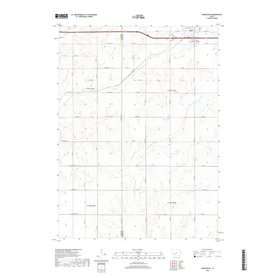
2018 Map of Adair South
USGS Topo · Published 2018About this map
Adair sits at the northern edge of this map, positioned where the high ground drops away into a network of fertile drainages. This landscape is defined by the headwaters of the W Fork Middle Nodaway River, which carves a path through the rolling terrain alongside Turkey Cr and Sevenmile Cr. The settlement pattern follows a rigorous section-line grid, connected by local thoroughfares such as Co HWY g30 and Dallas Rd. Genealogists and local historians will find significant landmarks on the eastern outskirts of the town, specifically Saint Johns Cem and Sunny Hill Cem. The southern reach of the quadrangle remains largely agricultural, showing the rural character of the Cass and Adair County border as it appeared in the late 2010s. The Adair Viaduct stands as a prominent engineering feature, facilitating transport over the primary east-west corridor.
Find a feature on this map
39 named features on this map. Tap any name to fly to it.
Don’t see what you’re looking for? This feature index may not catch every label — zoom into the map to look around manually.
Map Details
Editions of this 2018 Adair South Map
This is the sole edition of this map. No revisions or reprints were ever made.
Other maps of this area

1954 · Omaha
USGS Topo · 1:250,000

1957 · Omaha
USGS Topo · 1:250,000

1957 · Audubon
USGS Topo · 1:62,500

1958 · Omaha
USGS Topo · 1:250,000

1971 · Adair South
USGS Topo · 1:24,000

1971 · Anita
USGS Topo · 1:24,000

1971 · Fontanelle
USGS Topo · 1:24,000

1971 · Canby
USGS Topo · 1:24,000

1971 · Massena
USGS Topo · 1:24,000

1971 · Casey
USGS Topo · 1:24,000