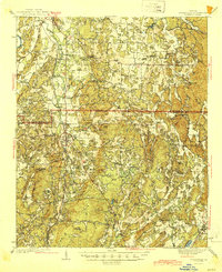
1944 Map of Adairsville
USGS Topo · Published 1944About this map
Adairsville serves as a central hub in this mid-century portrait of Gordon and Bartow counties. The landscape is defined by the ridge-and-valley topography of the lower Appalachians, where the Oostanaula River and Oothkalooga Creek carve through the terrain. The area's transit-oriented history is visible through the dual paths of the Louisville and Nashville and Nashville Chattanooga and St Louis RR, which paralleled the Old Dixie Highway to connect the region's agricultural and industrial centers.
Find a feature on this map
67 named features on this map. Tap any name to fly to it.
Don’t see what you’re looking for? This feature index may not catch every label — zoom into the map to look around manually.
Map Details
Editions of this 1944 Adairsville Map
2 editions found

Other maps of this area

1886 · Dalton
USGS Topo · 1:125,000

1886 · Ringgold
USGS Topo · 1:125,000

1886 · Rome
USGS Topo · 1:125,000

1890 · Cartersville
USGS Topo · 1:125,000

1891 · Cartersville
USGS Topo · 1:125,000

1892 · Ringgold
USGS Topo · 1:125,000

1892 · Dalton
USGS Topo · 1:125,000

1896 · Cartersville
USGS Topo · 1:125,000

1897 · Dalton
USGS Topo · 1:125,000

1898 · Rome
USGS Topo · 1:125,000