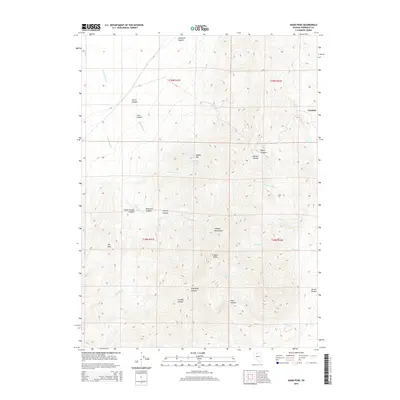
2015 Map of Adam Peak
USGS Topo · Published 2015About this map
Adam Peak stands as the literal and figurative high point of this high-desert landscape in the Osgood Mountains, part of the Great Basin terrain of northern Nevada. The mining district near Getchell marks the northeastern edge of the quadrangle, indicating the region's long-standing connection to mineral extraction. A complex network of drainage systems defines the topography, with E Fork Eden Cr and Soldier Cap Cr cutting through numerous named canyons. Water sources like Soldier Cap Spring provide critical points of interest in this arid environment, situated just south of the distinctive Soldier Cap formation. The map reveals a remote landscape where land management and natural features like the Dry Hills and Goughs Canyon predominate over human settlement, reflecting the isolated character of this portion of Humboldt County during the early 21st century.
Find a feature on this map
31 named features on this map. Tap any name to fly to it.
Don’t see what you’re looking for? This feature index may not catch every label — zoom into the map to look around manually.
Map Details
Editions of this 2015 Adam Peak Map
This is the sole edition of this map. No revisions or reprints were ever made.
Other maps of this area

1882 · Paradise
USGS Topo · 1:250,000

1893 · Paradise
USGS Topo · 1:250,000

1945 · Osgood Mountains
USGS Topo · 1:62,500

1945 · Hot Springs
USGS Topo · 1:62,500

1947 · Osgood Mountains
USGS Topo · 1:62,500

1947 · Hot Springs Peak
USGS Topo · 1:62,500

1955 · McDermitt
USGS Topo · 1:250,000

1959 · McDermitt
USGS Topo · 1:250,000

1980 · Dry Hills South
USGS Topo · 1:24,000
1980 · Red House Flat East
USGS Topo · 1:24,000