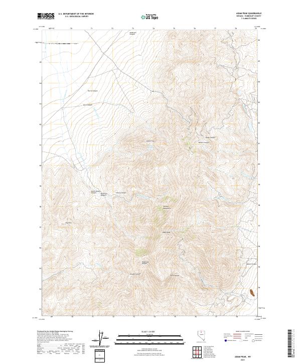
2021 Map of Adam Peak
USGS Topo · Published 2021About this map
Adam Peak stands as the central landmark in this high-altitude section of the Osgood Mountains in northern Nevada. The landscape is defined by a dense network of drainages and named canyons that carve through the desert range, including Hogshead Canyon, Cherry Canyon, and Reservoir Canyon. These deep incisions into the terrain often host ephemeral or perennial water sources essential for survival in this arid environment, such as the Soldiers Cap Spring located just below Soldier Cap. To the west, the Dry Hills offer a transition into the more open basins, while waterways like Eden Cr and its eastern fork flow through the northern reaches. The presence of numerous named canyons like Goughs Canyon and Felix Canyon suggests a topography historically significant for ranching or prospecting access within Humboldt County.
Find a feature on this map
29 named features on this map. Tap any name to fly to it.
Don’t see what you’re looking for? This feature index may not catch every label — zoom into the map to look around manually.
Map Details
Editions of this 2021 Adam Peak Map
This is the sole edition of this map. No revisions or reprints were ever made.
Other maps of this area

1882 · Paradise
USGS Topo · 1:250,000

1893 · Paradise
USGS Topo · 1:250,000

1945 · Osgood Mountains
USGS Topo · 1:62,500

1945 · Hot Springs
USGS Topo · 1:62,500

1947 · Osgood Mountains
USGS Topo · 1:62,500

1947 · Hot Springs Peak
USGS Topo · 1:62,500

1955 · McDermitt
USGS Topo · 1:250,000

1959 · McDermitt
USGS Topo · 1:250,000

1980 · Dry Hills South
USGS Topo · 1:24,000
1980 · Red House Flat East
USGS Topo · 1:24,000