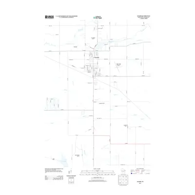
2013 Map of Adams
USGS Topo · Published 2013About this map
The adjacent communities of Friendship and Adams anchor this central Wisconsin landscape, where the flat glacial plain is interrupted by prominent sandstone bluffs. These distinctive geological features, including Friendship Mound, Houghton Rock, Lighthouse Rock, and Rattlesnake Mound, serve as towering landmarks above the surrounding creek-cut terrain. The area's hydrology is defined by the east-to-west flow of Little Roche a Cri Cr, which feeds into Friendship Lake before continuing toward the Wisconsin River. Cultural development is concentrated along the North Main Street corridor, featuring the Adams County Legion Field Airport and the Mound View Golf Course. This survey captures the transition from the dense street grids of the settlements to the sprawling agricultural and marshy lands drained by Duck Cr and Fairbanks Cr to the south.
Find a feature on this map
80 named features on this map. Tap any name to fly to it.
Don’t see what you’re looking for? This feature index may not catch every label — zoom into the map to look around manually.
Map Details
Editions of this 2013 Adams Map
This is the sole edition of this map. No revisions or reprints were ever made.
Other maps of this area

1955 · Green Bay
USGS Topo · 1:250,000

1957 · Madison
USGS Topo · 1:250,000

1958 · Arkdale
USGS Topo · 1:48,000

1958 · Coloma
USGS Topo · 1:48,000

1960 · Madison
USGS Topo · 1:250,000

1961 · Oxford
USGS Topo · 1:62,500

1961 · Adams
USGS Topo · 1:62,500

1967 · Roche A Cri
USGS Topo · 1:24,000
1967 · Arkdale
USGS Topo · 1:24,000

1968 · Coloma SW
USGS Topo · 1:24,000