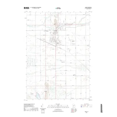
2018 Map of Adams
USGS Topo · Published 2018About this map
Friendship and Adams anchor this central Wisconsin landscape, where the geometry of urban streets meets the winding paths of Little Roche a Cri Creek and Fordham Cr. The map reveals a cluster of significant geologic landmarks that rise above the surrounding terrain, including Friendship Mound and Rattlesnake Mound, alongside distinctive features like Houghton Rock and Lighthouse Rock. These elevations provided natural vantage points and historical navigation markers in a region otherwise characterized by wetlands like Tamarack Swamp. For those researching family history, the map includes precisely located sites such as Saint Leo's Cem and Mount Repose Cem. The presence of the Adams County Legion Field and a network of rural roads including Czech Ave and Dyke Ave illustrates the continued development and community structure of the county seat area in the early 21st century.
Find a feature on this map
51 named features on this map. Tap any name to fly to it.
Don’t see what you’re looking for? This feature index may not catch every label — zoom into the map to look around manually.
Map Details
Editions of this 2018 Adams Map
This is the sole edition of this map. No revisions or reprints were ever made.
Other maps of this area

1955 · Green Bay
USGS Topo · 1:250,000

1957 · Madison
USGS Topo · 1:250,000

1958 · Arkdale
USGS Topo · 1:48,000

1958 · Coloma
USGS Topo · 1:48,000

1960 · Madison
USGS Topo · 1:250,000

1961 · Oxford
USGS Topo · 1:62,500

1961 · Adams
USGS Topo · 1:62,500

1967 · Roche A Cri
USGS Topo · 1:24,000
1967 · Arkdale
USGS Topo · 1:24,000

1968 · Coloma SW
USGS Topo · 1:24,000