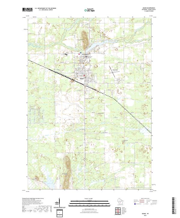
2022 Map of Adams
USGS Topo · Published 2022About this map
The Adams County Courthouse serves as the focal point of the adjacent settlements of Friendship and Adams, marking a center of local governance and community life. This landscape is defined by its unique glacial and geological remnants, including prominent landforms such as Friendship Mound and Rattlesnake Mound that rise above the surrounding terrain. To the south, the expansive Tammarack Swamp and several outcrops like Houghton Rock and Lighthouse Rock illustrate the varied geography of this portion of central Wisconsin.
Find a feature on this map
56 named features on this map. Tap any name to fly to it.
Don’t see what you’re looking for? This feature index may not catch every label — zoom into the map to look around manually.
Map Details
Editions of this 2022 Adams Map
This is the sole edition of this map. No revisions or reprints were ever made.