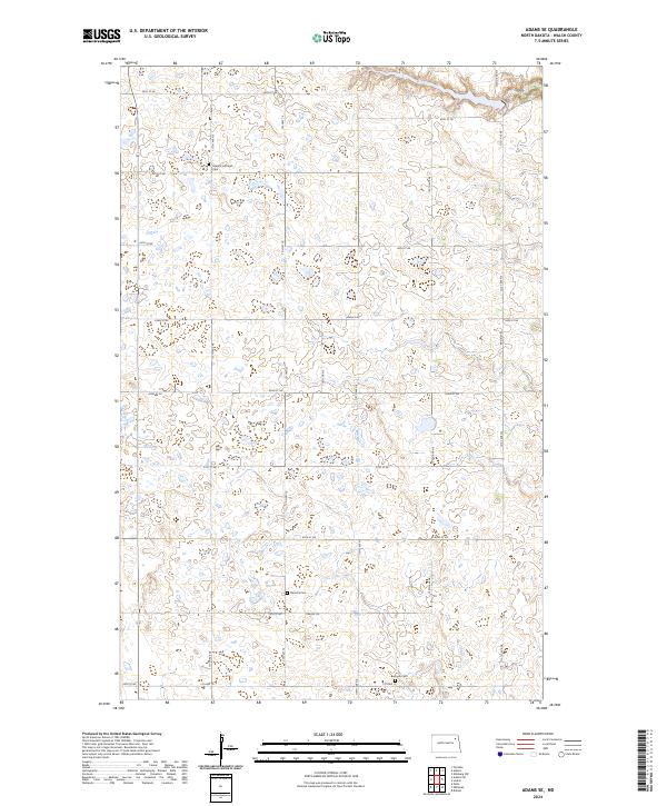
2024 Map of Adams SE
USGS Topo · Published 2024About this map
The agrarian landscape of Walsh County is defined by a rigorous grid of section lines and the conservation lands of the Walsh County Waterfowl Production Area. This area of North Dakota retains a strong connection to its early 20th-century settlement patterns, evidenced by the preserved locations of community burial grounds. Scattered across the prairie are the Sarepta Lutheran Cem, Narodni Cem, and Bechyne Cem, which often represent the last visible landmarks of the region's ethnic pioneer congregations. The terrain is navigated via a network of local connectors like Co Hwy 16 and rural routes such as Prairie Trl, linking isolated farmsteads and agricultural sections within township boundaries like t156n r58w and t157n r57w.
Find a feature on this map
27 named features on this map. Tap any name to fly to it.
Don’t see what you’re looking for? This feature index may not catch every label — zoom into the map to look around manually.
Map Details
Editions of this 2024 Adams SE Map
This is the sole edition of this map. No revisions or reprints were ever made.
Other maps of this area

1952 · Thief River Falls
USGS Topo · 1:250,000

1953 · Devils Lake
USGS Topo · 1:250,000

1956 · Thief River Falls
USGS Topo · 1:250,000

1956 · Devils Lake
USGS Topo · 1:250,000

1957 · Thief River Falls
USGS Topo · 1:250,000

1967 · Thief River Falls
USGS Topo · 1:250,000

1971 · Whitman
USGS Topo · 1:24,000
1971 · Dahlen
USGS Topo · 1:24,000

1971 · Pelto
USGS Topo · 1:24,000

1972 · Adams
USGS Topo · 1:24,000