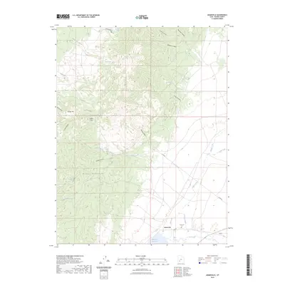
2023 Map of Adamsville
USGS Topo · Published 2023About this map
The settlement of Adamsville sits at the southern edge of the Mineral Mountains, where the Beaver River feeds into the Minersville Reservoir. This area in Beaver County illustrates the vital relationship between high-desert terrain and water management, evidenced by the Furnace Ditch and reservoirs that capture runoff from the high peaks. The landscape transitions from the jagged elevations of Harkley Mtn and Granite Canyon in the west to the alluvial plains of Wildcat Creek and Indian Creek in the east.
Find a feature on this map
32 named features on this map. Tap any name to fly to it.
Don’t see what you’re looking for? This feature index may not catch every label — zoom into the map to look around manually.
Map Details
Editions of this 2023 Adamsville Map
This is the sole edition of this map. No revisions or reprints were ever made.
Other maps of this area

1885 · Beaver
USGS Topo · 1:250,000

1953 · Minersville
USGS Topo · 1:24,000

1953 · Cave Canyon
USGS Topo · 1:24,000

1953 · Richfield
USGS Topo · 1:250,000

1958 · Richfield
USGS Topo · 1:250,000

1958 · Minersville
USGS Topo · 1:62,500

1958 · Beaver
USGS Topo · 1:62,500

1958 · Adamsville
USGS Topo · 1:62,500

1958 · Ranch Canyon
USGS Topo · 1:24,000
1971 · Greenville Bench
USGS Topo · 1:24,000