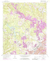
1959 Map of Adamsville
USGS Topo · Published 1987About this map
The industrial and residential expansion of western Birmingham is visible in this mid-century survey, where coal mining and suburban growth intersect. Centered on Adamsville, the landscape is defined by the heavy infrastructure of the St Louis San Francisco Railroad and the Birmingham Southern Railroad. Prominent coal operations, including the Mulga Mine and various Strip Mines near Daisey City, are surrounded by established company towns and newer developments like Forestdale and Hillview. The winding course of Village Creek feeds into Bayview Lake, a significant water feature that separates the mining communities of Mulga and Edgewater from the residential districts to the east. Local history is preserved in numerous community hubs like Bivens Chapel, McDonald Chapel, and the Village Falls Ch, while the northern edge of the map identifies the curious locality of Red Wine and the slopes of Glasgow Hill.
Find a feature on this map
94 named features on this map. Tap any name to fly to it.
Don’t see what you’re looking for? This feature index may not catch every label — zoom into the map to look around manually.
Map Details
Editions of this 1959 Adamsville Map
4 editions found
Other maps of this area

1889 · Birmingham
USGS Topo · 1:125,000

1890 · Bessemer
USGS Topo · 1:125,000

1892 · Birmingham
USGS Topo · 1:125,000

1892 · Bessemer
USGS Topo · 1:125,000

1893 · Jasper
USGS Topo · 1:125,000

1895 · Birmingham
USGS Topo · 1:125,000

1899 · Brookwood
USGS Topo · 1:125,000

1904 · Birmingham Coal District
USGS Topo · 1:62,500

1905 · Bessemer Iron District
USGS Topo · 1:62,500

1906 · Birmingham Special
USGS Topo · 1:62,500