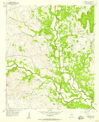
1954 Map of Adamsville
USGS Topo · Published 1957About this map
Adamsville serves as the central hub of this central Texas landscape, situated where the American Legion Memorial Highway follows the winding valley of the Lampasas River. The terrain is defined by a series of drainages, including North Turkey Creek and South Turkey Creek, which cut through the limestone hills. Evidence of mid-century rural life is scattered across the quadrangle, notably at the Friendship Sch and family burial sites like Straley Cem and Townsen Cem. A particularly distinctive Cold War era feature is the USAF Practice Bomb Target located in the southwestern hills near Onion Top. This mix of traditional ranching geography and military activity reflects the dual nature of the region's mid-1950s development, where ancient creek beds like Kinchelo Creek and Simms Creek remain the primary landmarks alongside modern aerial training grounds.
Find a feature on this map
18 named features on this map. Tap any name to fly to it.
Don’t see what you’re looking for? This feature index may not catch every label — zoom into the map to look around manually.
Map Details
Editions of this 1954 Adamsville Map
2 editions found
Other maps of this area

1887 · Lampasas
USGS Topo · 1:125,000

1894 · Lampasas
USGS Topo · 1:125,000

1954 · Brownwood
USGS Topo · 1:250,000

1954 · Evant
USGS Topo · 1:62,500

1954 · Lampasas
USGS Topo · 1:62,500

1954 · Evant
USGS Topo · 1:24,000
1954 · Izoro
USGS Topo · 1:24,000
1954 · Flat Top Peak
USGS Topo · 1:24,000
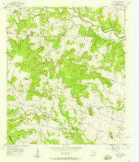
1954 · Pearl
USGS Topo · 1:24,000
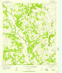
1954 · Rumley
USGS Topo · 1:24,000