
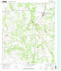
1954 Map of Evant
USGS Topo · Published 1957About this map
Evant serves as the focal point of this Central Texas landscape where Coryell, Hamilton, and Lampasas counties meet. The settlement patterns of the mid-1950s are defined by small, family-linked landmarks and vital water sources like Brooks Spring and Beef Pen Spring. Transportation revolves around the American Legion Memorial Highway, which intersects the town, while a major pipe line cuts across the western hills, indicating the era's energy infrastructure.
Find a feature on this map
30 named features on this map. Tap any name to fly to it.
Don’t see what you’re looking for? This feature index may not catch every label — zoom into the map to look around manually.
Map Details
Editions of this 1954 Evant Map
2 editions found
Other maps of this area

1887 · Lampasas
USGS Topo · 1:125,000

1888 · Hamilton
USGS Topo · 1:125,000

1894 · Hamilton
USGS Topo · 1:125,000

1894 · Lampasas
USGS Topo · 1:125,000

1954 · Brownwood
USGS Topo · 1:250,000

1954 · Evant
USGS Topo · 1:62,500
1954 · Izoro
USGS Topo · 1:24,000
1954 · Pearl
USGS Topo · 1:24,000
1954 · Adamsville
USGS Topo · 1:24,000

1956 · Pottsville
USGS Topo · 1:62,500