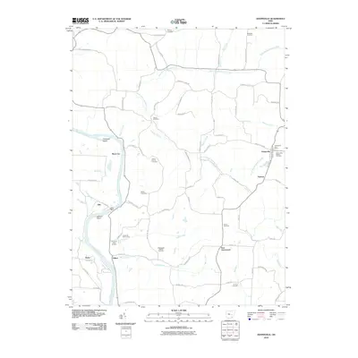
2010 Map of Adamsville
USGS Topo · Published 2010About this map
The Muskingum River flows through the western edge of this Muskingum County landscape, anchored by the community of Adamsville in the east. The river corridor is marked by hydraulic and institutional landmarks, including Ellis Dam and the nearby Zanesville State Nursery. The interior terrain is defined by the branching network of Symmes Creek, with numerous smaller tributaries like Blount Run and Beech Run carving the uplands.
Find a feature on this map
74 named features on this map. Tap any name to fly to it.
Don’t see what you’re looking for? This feature index may not catch every label — zoom into the map to look around manually.
Map Details
Editions of this 2010 Adamsville Map
This is the sole edition of this map. No revisions or reprints were ever made.
Other maps of this area

1908 · Conesville
USGS Topo · 1:62,500

1910 · Frazeysburg
USGS Topo · 1:62,500

1910 · Philo
USGS Topo · 1:62,500

1910 · Zanesville
USGS Topo · 1:62,500

1910 · Conesville
USGS Topo · 1:62,500

1947 · Columbus
USGS Topo · 1:250,000

1949 · Clarksburg
USGS Topo · 1:250,000

1950 · Marion
USGS Topo · 1:250,000

1951 · Canton
USGS Topo · 1:250,000

1953 · Canton
USGS Topo · 1:250,000