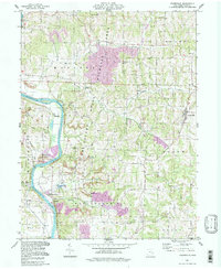
1994 Map of Adamsville
USGS Topo · Published 1998About this map
The Muskingum River dominates the western edge of this landscape, its banks lined with diverse land-use patterns from the Zanesville State Nursery to industrial zones like the Gravel Pit near Ellis Dam. Further east, the terrain shifts into a network of creek branches and agricultural valleys where the settlement of Adamsville serves as a local hub. The map reveals an area defined by natural resource extraction and conservation, with numerous Strip Mines and Gas Wells interspersed between large protected areas like the Tri-Valley State Wildlife Area and Powelson State Wildlife Area.
Find a feature on this map
41 named features on this map. Tap any name to fly to it.
Don’t see what you’re looking for? This feature index may not catch every label — zoom into the map to look around manually.
Map Details
Editions of this 1994 Adamsville Map
This is the sole edition of this map. No revisions or reprints were ever made.
Other maps of this area

1908 · Conesville
USGS Topo · 1:62,500

1910 · Frazeysburg
USGS Topo · 1:62,500

1910 · Philo
USGS Topo · 1:62,500

1910 · Zanesville
USGS Topo · 1:62,500

1910 · Conesville
USGS Topo · 1:62,500

1947 · Columbus
USGS Topo · 1:250,000

1949 · Clarksburg
USGS Topo · 1:250,000

1950 · Marion
USGS Topo · 1:250,000

1951 · Canton
USGS Topo · 1:250,000

1953 · Canton
USGS Topo · 1:250,000