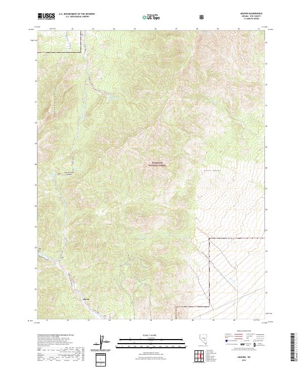
2021 Map of Adaven
USGS Topo · Published 2021About this map
Adaven sits at the southern edge of this high-elevation terrain in Nye County, marking a rare point of named settlement within the expansive Humboldt National Forest. The landscape is dominated by the convergence of the Quinn Canyon Range and the Grant Range, divided by the prominent Cherry Creek Summit. This area is defined by its complex drainage network, where seasonal water sources like Horse Spring, Cherry Spring, and Burnt Canyon Spring sustain the dry environment. The presence of Sawmill Canyon suggests the historical importance of timber resources in this remote high-country setting, while the network of primitive routes such as the Burnt Canyon Trl and Bruno Canyon Trl indicates how early travelers navigated the steep canyons. Water remains the primary focal point of the geography, with Cherry Creek and Bruno Cr carving deep paths through the township boundaries of this isolated Nevada interior.
Find a feature on this map
31 named features on this map. Tap any name to fly to it.
Don’t see what you’re looking for? This feature index may not catch every label — zoom into the map to look around manually.
Map Details
Editions of this 2021 Adaven Map
This is the sole edition of this map. No revisions or reprints were ever made.
Other maps of this area

1956 · Lund
USGS Topo · 1:250,000

1960 · Lund
USGS Topo · 1:250,000

1964 · Troy Canyon
USGS Topo · 1:62,500

1964 · Forest Home
USGS Topo · 1:62,500

1985 · Adaven
USGS Topo · 1:24,000
1985 · Badger Gulch
USGS Topo · 1:24,000
1985 · Wadsworth Ranch
USGS Topo · 1:24,000
1985 · Water Gap NW
USGS Topo · 1:24,000
1985 · Nyala
USGS Topo · 1:24,000
1985 · Water Gap West
USGS Topo · 1:24,000