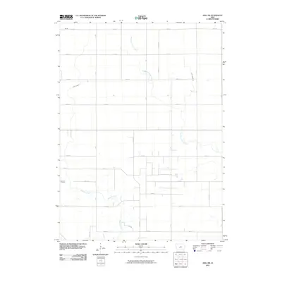
2010 Map of Adel NW
USGS Topo · Published 2010About this map
The settlement of Brough occupies the northwestern corner of this Linn Township landscape, an area defined by the headwaters and drainage of the West Branch Panther Creek. The map reveals a strictly regulated agricultural grid, where rural life follows the intersection of roads like F Ave and 220th St. Central to the community's history is the West Linn Cemetery, situated near the banks of Mosquito Creek in the southwest. This hydrological network is further modified by engineered drainage features like Ditch Number 4 and Ditch Number 41, illustrating how the natural prairie terrain has been adapted for intensive cultivation. The placement of these cemeteries and named creek branches provides essential geographic anchors for those tracing family history or early land use in Dallas County.
Find a feature on this map
30 named features on this map. Tap any name to fly to it.
Don’t see what you’re looking for? This feature index may not catch every label — zoom into the map to look around manually.
Map Details
Editions of this 2010 Adel NW Map
This is the sole edition of this map. No revisions or reprints were ever made.
Other maps of this area

1949 · Adel
USGS Topo · 1:62,500

1950 · Perry
USGS Topo · 1:62,500

1951 · Perry
USGS Topo · 1:62,500

1951 · Adel
USGS Topo · 1:62,500

1952 · Panora
USGS Topo · 1:62,500

1954 · Bagley
USGS Topo · 1:62,500

1954 · Omaha
USGS Topo · 1:250,000

1957 · Omaha
USGS Topo · 1:250,000

1958 · Omaha
USGS Topo · 1:250,000
1982 · Panther
USGS Topo · 1:24,000