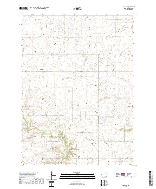
2022 Map of Adel NW
USGS Topo · Published 2022About this map
Mosquito Cr and W Br Panther Cr wind through this central Iowa agricultural landscape, defining the drainage patterns of the rural townships north of Adel. The area is characterized by a high-density grid of gravel roads and section lines, including Co Hwy P46, El Paso Ave, and Houston Pl, which connect isolated farmsteads across the prairie. A notable industrial feature is the underground reservoir managed by the Gas Storage Northern Natural Gas Co, located near the center of the sheet. Genealogists will find the West Linn Cem situated in the western portion of the quadrangle near the banks of Mosquito Cr, serving as a primary point of historical interest in an otherwise modern farming corridor.
Find a feature on this map
35 named features on this map. Tap any name to fly to it.
Don’t see what you’re looking for? This feature index may not catch every label — zoom into the map to look around manually.
Map Details
Editions of this 2022 Adel NW Map
This is the sole edition of this map. No revisions or reprints were ever made.
Other maps of this area

1949 · Adel
USGS Topo · 1:62,500

1950 · Perry
USGS Topo · 1:62,500

1951 · Perry
USGS Topo · 1:62,500

1951 · Adel
USGS Topo · 1:62,500

1952 · Panora
USGS Topo · 1:62,500

1954 · Bagley
USGS Topo · 1:62,500

1954 · Omaha
USGS Topo · 1:250,000

1957 · Omaha
USGS Topo · 1:250,000

1958 · Omaha
USGS Topo · 1:250,000
1982 · Panther
USGS Topo · 1:24,000