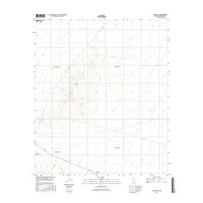
2017 Map of Aden Hills
USGS Topo · Published 2017About this map
Aden Hills dominate the topography of this high desert region in Dona Ana County, rising distinctly above the surrounding basin. This 2017 survey documents the sparse but critical network of rural routes, including Afton Rd and several numbered county roads like Co Rd B004 and Co Rd B 002 that navigate the varied elevation. The map identifies two specific local points of interest: the settlement area of Pronto and the prominent landmark of Mount Aden situated in the southwestern corner. These labels reflect the localized naming conventions of the Chihuahuan Desert landscape, where even small peaks and crossroads serve as vital navigational anchors for residents and researchers. The survey also clearly delineates the Public Land Survey System grid across four townships, providing a clear framework for property and land management research.
Find a feature on this map
13 named features on this map. Tap any name to fly to it.
Don’t see what you’re looking for? This feature index may not catch every label — zoom into the map to look around manually.
Map Details
Editions of this 2017 Aden Hills Map
This is the sole edition of this map. No revisions or reprints were ever made.
Other maps of this area

1891 · Las Cruces
USGS Topo · 1:125,000

1893 · Las Cruces
USGS Topo · 1:125,000

1941 · Las Cruces
USGS Topo · 1:62,500

1941 · Aden
USGS Topo · 1:62,500

1943 · Aden
USGS Topo · 1:62,500

1943 · Corralitos Ranch
USGS Topo · 1:62,500

1943 · Afton
USGS Topo · 1:62,500

1943 · Las Cruces
USGS Topo · 1:62,500

1955 · Las Cruces
USGS Topo · 1:250,000

1958 · Las Cruces
USGS Topo · 1:250,000