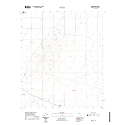
2020 Map of Aden Hills
USGS Topo · Published 2020About this map
Aden Hills dominates this high-desert landscape in Doña Ana County, where the terrain rises from the surrounding basin towards the prominent volcanic features of the southern New Mexico corridor. The 2020 topography illustrates a remote environment characterized by significant public land management and recreational use, notably the Aden Hills OHV - Trail System which snakes through the western elevations. In the southern reaches of the map, the small settlement of Pronto sits along the roadway network, while Aden Mtn stands as a distinct landmark further west. The infrastructure is defined by a sparse but vital network of county roads including Co Rd B004 and Afton Rd, which provide access through the desert flats and connect the isolated settlements and topographic landmarks of the region.
Find a feature on this map
14 named features on this map. Tap any name to fly to it.
Don’t see what you’re looking for? This feature index may not catch every label — zoom into the map to look around manually.
Map Details
Editions of this 2020 Aden Hills Map
This is the sole edition of this map. No revisions or reprints were ever made.
Other maps of this area

1891 · Las Cruces
USGS Topo · 1:125,000

1893 · Las Cruces
USGS Topo · 1:125,000

1941 · Las Cruces
USGS Topo · 1:62,500

1941 · Aden
USGS Topo · 1:62,500

1943 · Aden
USGS Topo · 1:62,500

1943 · Corralitos Ranch
USGS Topo · 1:62,500

1943 · Afton
USGS Topo · 1:62,500

1943 · Las Cruces
USGS Topo · 1:62,500

1955 · Las Cruces
USGS Topo · 1:250,000

1958 · Las Cruces
USGS Topo · 1:250,000