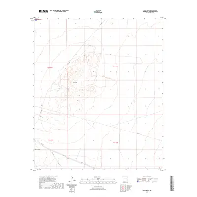
2023 Map of Aden Hills
USGS Topo · Published 2023About this map
The Aden Hills rise from the desert floor in this contemporary survey of Doña Ana County, New Mexico. The landscape is primarily defined by the intricate network of the Aden Hills Ohv - Trail System Trl, which winds through the central elevations. This area, managed for off-highway vehicle recreation, shows a modern land-use pattern where recreation trails intersect with established desert routes like Afton Rd and several county roads. In the southwestern corner, the terrain transitions toward Aden Mountain, with its proximity to old transportation corridors like Co Rd B004 and Co Rd B002. The grid of the Public Land Survey System, including t24s r3w and t24s r2w, provides the underlying structure for this arid expanse, illustrating how modern recreational infrastructure is overlaid upon traditional section boundaries in the High Desert.
Find a feature on this map
13 named features on this map. Tap any name to fly to it.
Don’t see what you’re looking for? This feature index may not catch every label — zoom into the map to look around manually.
Map Details
Editions of this 2023 Aden Hills Map
This is the sole edition of this map. No revisions or reprints were ever made.
Other maps of this area

1891 · Las Cruces
USGS Topo · 1:125,000

1893 · Las Cruces
USGS Topo · 1:125,000

1941 · Las Cruces
USGS Topo · 1:62,500

1941 · Aden
USGS Topo · 1:62,500

1943 · Aden
USGS Topo · 1:62,500

1943 · Corralitos Ranch
USGS Topo · 1:62,500

1943 · Afton
USGS Topo · 1:62,500

1943 · Las Cruces
USGS Topo · 1:62,500

1955 · Las Cruces
USGS Topo · 1:250,000

1958 · Las Cruces
USGS Topo · 1:250,000