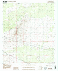
1996 Map of Aden Hills
USGS Topo · Published 2001About this map
The Aden Hills dominate this high-desert landscape in Doña Ana County, where the topography is defined by isolation and utility. The small settlement of Aden sits near the southwestern edge of the hills, marking a focal point of human activity in an area otherwise characterized by vast infrastructure. A Pipeline and a Trans. Line cut through the terrain, illustrating the region's role as a corridor for energy and communication. Local life is glimpsed through practical landmarks such as a Corral and Indian Tank, which suggest the enduring presence of ranching and water management in an arid environment. Near the southern survey boundary, the presence of a Gravel Pit and a Rest Area further indicates the intersection of resource extraction and transit that shapes this New Mexico desert.
Find a feature on this map
10 named features on this map. Tap any name to fly to it.
Don’t see what you’re looking for? This feature index may not catch every label — zoom into the map to look around manually.
Map Details
Editions of this 1996 Aden Hills Map
This is the sole edition of this map. No revisions or reprints were ever made.
Other maps of this area

1891 · Las Cruces
USGS Topo · 1:125,000

1893 · Las Cruces
USGS Topo · 1:125,000

1941 · Las Cruces
USGS Topo · 1:62,500

1941 · Aden
USGS Topo · 1:62,500

1943 · Aden
USGS Topo · 1:62,500

1943 · Corralitos Ranch
USGS Topo · 1:62,500

1943 · Afton
USGS Topo · 1:62,500

1943 · Las Cruces
USGS Topo · 1:62,500

1955 · Las Cruces
USGS Topo · 1:250,000

1958 · Las Cruces
USGS Topo · 1:250,000