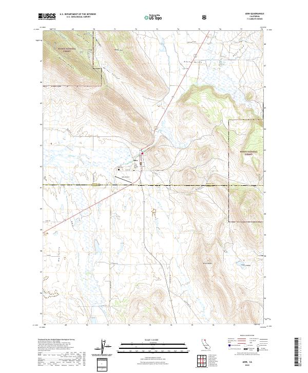
2022 Map of Adin
USGS Topo · Published 2022About this map
Adin serves as the focal point for this Northeastern California landscape, situated where the high desert terrain meets the southern reaches of the Modoc National Forest. The settlement's history is preserved at the Adin Pioneer Cem and Adin Cem, reflecting the generations who established themselves along the banks of Ash Creek. The geography is defined by a series of distinct valleys and uplands, including Round Valley and Big Valley, which are partitioned by the rugged forms of Brisco Butte and Ryan Ridge. A complex network of water features like the Big Swamp and Butte Cr suggests a seasonally varied hydrology that has long influenced ranching and transit through Barber Canyon. The map clearly illustrates the transition from the Modoc County line into Lassen County, showing how modern infrastructure like the Adin Airport integrates with older routes like Ash Valley Rd.
Find a feature on this map
40 named features on this map. Tap any name to fly to it.
Don’t see what you’re looking for? This feature index may not catch every label — zoom into the map to look around manually.
Map Details
Editions of this 2022 Adin Map
This is the sole edition of this map. No revisions or reprints were ever made.
Other maps of this area

1886 · Alturas
USGS Topo · 1:250,000

1886 · Modoc Lava Bed
USGS Topo · 1:250,000

1892 · Modoc Lava-Bed
USGS Topo · 1:250,000

1892 · Alturas
USGS Topo · 1:250,000

1954 · Alturas
USGS Topo · 1:250,000

1958 · Alturas
USGS Topo · 1:250,000

1961 · Canby
USGS Topo · 1:62,500

1961 · Bieber
USGS Topo · 1:62,500

1962 · Alturas
USGS Topo · 1:250,000

1962 · Crank Mountain
USGS Topo · 1:62,500