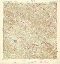
1946 Map of Adjuntas
USGS Topo · Published 1946About this map
Cordillera Central mountain peaks dominate this 1940s landscape, reflecting a rugged interior where coffee production and subsistence farming shaped the local economy. The town of Adjuntas serves as the central hub, surrounded by a dense network of family-owned estates such as Hacienda Artau, Hacienda Santa Elena, and Hacienda La Gloria. These haciendas, often located near water sources like the Rio Arecibo and Rio Jauca, highlight the island's traditional agricultural structure before mid-century industrialization fully took hold. The presence of Central Pellejas indicates the importance of processing centers within the mountain valleys. To the south, the recently created Lago Garzas marks a significant hydraulic feature, while landmarks like the Iglesia de la Concepción Inmaculada and Iglesia de San Patricio anchor the spiritual life of the mountain communities.
Find a feature on this map
45 named features on this map. Tap any name to fly to it.
Don’t see what you’re looking for? This feature index may not catch every label — zoom into the map to look around manually.
Map Details
Editions of this 1946 Adjuntas Map
2 editions found
Other maps of this area

1945 · Ponce
USGS Topo · 1:30,000

1946 · Utuado
USGS Topo · 1:30,000

1946 · Bayaney
USGS Topo · 1:30,000

1946 · Yauco
USGS Topo · 1:30,000

1946 · Jayuya
USGS Topo · 1:30,000

1946 · Monte Guilarte
USGS Topo · 1:30,000

1946 · Florida
USGS Topo · 1:30,000

1946 · Penuelas
USGS Topo · 1:30,000

1946 · Adjuntas
USGS Topo · 1:30,000
1947 · Yauco NE
USGS Topo · 1:10,000
Featured Places
- Adjuntas
- Chorreras, Utuado
- Altos de Arena, Utuado
- Sector Los Verdes, Adjuntas
- Sector Vickey Oquendo, Adjuntas