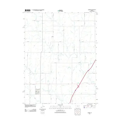
2012 Map of Admire
USGS Topo · Published 2012About this map
Admire occupies a central position in this Kansas landscape, where the town plat is defined by a grid including Main St, Everest St, and Admire St. A local Po serves as a community landmark within the settlement, which is flanked by the winding course of One Hundred and Fortytwo Mile Cr. This waterway, along with Elm Cr and Onion Cr, creates a dendritic drainage pattern across the region, influencing the placement of early road networks like Road 380 and Road 400. For those researching family history, the map identifies Admire Cem just west of the main settlement and Pleasant Ridge Cem to the north, providing precise locations for these local burial grounds. The intersection of rural routes and natural creek beds highlights the transition of this area into a modern agricultural corridor.
Find a feature on this map
44 named features on this map. Tap any name to fly to it.
Don’t see what you’re looking for? This feature index may not catch every label — zoom into the map to look around manually.
Map Details
Editions of this 2012 Admire Map
This is the sole edition of this map. No revisions or reprints were ever made.
Other maps of this area

1885 · Eskridge
USGS Topo · 1:125,000

1889 · Burlingame
USGS Topo · 1:125,000

1889 · Eskridge
USGS Topo · 1:125,000

1894 · Eskridge
USGS Topo · 1:125,000

1894 · Burlingame
USGS Topo · 1:125,000

1947 · Lawrence
USGS Topo · 1:250,000

1950 · Lawrence
USGS Topo · 1:250,000

1952 · Harveyville
USGS Topo · 1:24,000

1955 · Hutchinson
USGS Topo · 1:250,000

1956 · Lawrence
USGS Topo · 1:250,000