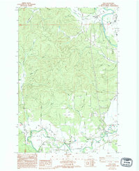
1986 Map of Adna
USGS Topo · Published 1994About this map
The Chehalis River valley defines the southern and eastern corridors of this mid-1980s landscape, where several historic river-oriented settlements are concentrated. Small clusters at Adna, Littell, and Millburn line the river's path, while the northern edge is marked by the small community of Galvin near the confluence of Valley Creek and Lincoln Creek. This area shows a transition from the level floodplain, managed by the Scheuber Ditch, into the more complex drainage systems of the interior hills.
Find a feature on this map
29 named features on this map. Tap any name to fly to it.
Don’t see what you’re looking for? This feature index may not catch every label — zoom into the map to look around manually.
Map Details
Editions of this 1986 Adna Map
2 editions found
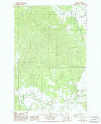
Other maps of this area

1916 · Chehalis
USGS Topo · 1:125,000

1940 · Tenino
USGS Topo · 1:62,500

1941 · Meskill
USGS Topo · 1:62,500

1941 · Gate
USGS Topo · 1:62,500

1944 · Tenino
USGS Topo · 1:62,500

1949 · Tenino
USGS Topo · 1:62,500

1953 · Hoquiam
USGS Topo · 1:250,000

1953 · Rochester
USGS Topo · 1:62,500

1953 · Adna
USGS Topo · 1:62,500

1954 · Centralia
USGS Topo · 1:62,500