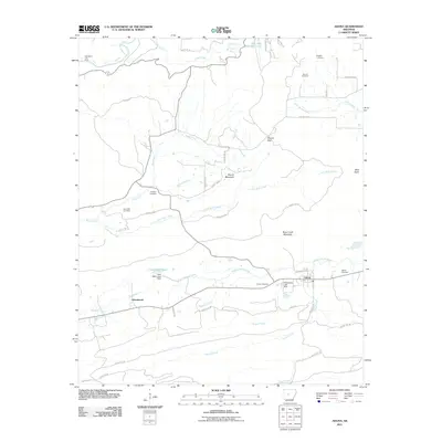
2011 Map of Adona
USGS Topo · Published 2011About this map
The Petit Jean River winds through this central Arkansas corridor, framing a landscape defined by significant elevation changes and rural settlements. In the south, the community of Adona serves as a local hub along the Railroad, flanked by Homewood to the west. The terrain is marked by prominent heights including Rose Creek Mountain and Round Mountain, with the northern reaches dominated by the waters of Petit Jean State Park Lake and the dramatic drop of Cedar Falls. This survey provides a clear view of the area's ancestral geography, documenting numerous family and community burial grounds such as Aunt Dilly Cemetery, Hamilton Cemetery, and Higgins Cemetery. These sites, along with smaller water bodies like Clear Water Lake and Mulberry Creek, illustrate a long-established pattern of small-scale agriculture and land use in the river valley before more modern development reached the area.
Find a feature on this map
56 named features on this map. Tap any name to fly to it.
Don’t see what you’re looking for? This feature index may not catch every label — zoom into the map to look around manually.
Map Details
Editions of this 2011 Adona Map
This is the sole edition of this map. No revisions or reprints were ever made.
Other maps of this area

1888 · Dardanelle #4
USGS Topo · 1:62,500

1889 · Morrilton No. 3
USGS Topo · 1:62,500

1890 · Benton
USGS Topo · 1:125,000

1890 · Hot Springs
USGS Topo · 1:125,000

1890 · Dardanelle
USGS Topo · 1:125,000

1892 · Morrillton
USGS Topo · 1:125,000

1894 · Morrillton
USGS Topo · 1:125,000

1894 · Hot Springs
USGS Topo · 1:125,000

1894 · Benton
USGS Topo · 1:125,000

1955 · Little Rock
USGS Topo · 1:250,000