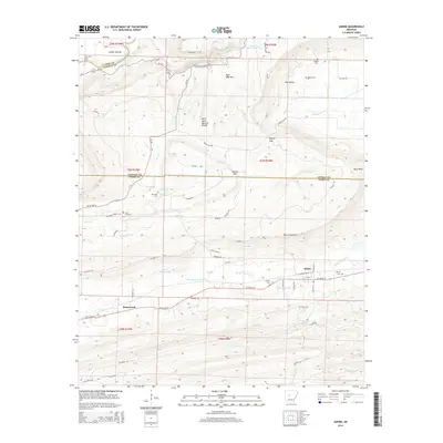
2014 Map of Adona
USGS Topo · Published 2014About this map
The Petit Jean River and its surrounding highlands define this portion of the Arkansas River Valley, where the Petit Jean Mountain plateau drops sharply toward the lowlands of Carden Bottom. This 2014 survey documents the rugged landscape around Adona, where the geological formation of Petit Jean Natural Bridge stands as a notable landmark near Add Valley. The settlement pattern follows the drainages and valleys, with Homewood situated along the southern corridor and small family-named cemeteries such as Aunt Dilly Cem and Barnes Cem scattered throughout the rural terrain.
Find a feature on this map
62 named features on this map. Tap any name to fly to it.
Don’t see what you’re looking for? This feature index may not catch every label — zoom into the map to look around manually.
Map Details
Editions of this 2014 Adona Map
This is the sole edition of this map. No revisions or reprints were ever made.
Other maps of this area

1888 · Dardanelle #4
USGS Topo · 1:62,500

1889 · Morrilton No. 3
USGS Topo · 1:62,500

1890 · Benton
USGS Topo · 1:125,000

1890 · Hot Springs
USGS Topo · 1:125,000

1890 · Dardanelle
USGS Topo · 1:125,000

1892 · Morrillton
USGS Topo · 1:125,000

1894 · Morrillton
USGS Topo · 1:125,000

1894 · Hot Springs
USGS Topo · 1:125,000

1894 · Benton
USGS Topo · 1:125,000

1955 · Little Rock
USGS Topo · 1:250,000