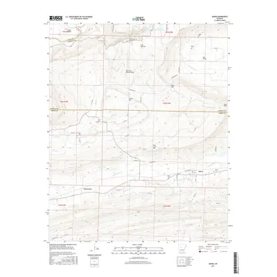
2017 Map of Adona
USGS Topo · Published 2017About this map
Adona and the surrounding Arkansas river valley landscape are defined by the dramatic rise of Petit Jean Mountain and Rose Creek Mtn. The 2017 survey details a region where high plateaus drop sharply into fertile lowlands like Carden Bottom and Ada Valley. For genealogists, the map is particularly rich in family-named burial sites, including Hamilton Cem, Aunt Dilly Cem, Fowler Cem, and Higgins Cem, many of which are situated along the winding paths of Rocky Cypress Cr and Mulberry Cr. Civil engineering is represented by the Railroad Ave corridor in Adona, while natural landmarks like the Petit Jean Natural Bridge and Cedar Falls highlight the unique geological formations of the area. This record provides an essential look at the modern rural layout of Perry and Conway counties.
Find a feature on this map
68 named features on this map. Tap any name to fly to it.
Don’t see what you’re looking for? This feature index may not catch every label — zoom into the map to look around manually.
Map Details
Editions of this 2017 Adona Map
This is the sole edition of this map. No revisions or reprints were ever made.
Other maps of this area

1888 · Dardanelle #4
USGS Topo · 1:62,500

1889 · Morrilton No. 3
USGS Topo · 1:62,500

1890 · Benton
USGS Topo · 1:125,000

1890 · Hot Springs
USGS Topo · 1:125,000

1890 · Dardanelle
USGS Topo · 1:125,000

1892 · Morrillton
USGS Topo · 1:125,000

1894 · Morrillton
USGS Topo · 1:125,000

1894 · Hot Springs
USGS Topo · 1:125,000

1894 · Benton
USGS Topo · 1:125,000

1955 · Little Rock
USGS Topo · 1:250,000