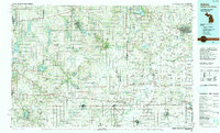
1990 Map of Adrian
USGS Topo · Published 1991About this map
The Tri-State borderlands of Michigan, Ohio, and Indiana converge in this detailed topographic study, centered on the agricultural and industrial hub of Adrian. The landscape is defined by the headwaters of the Sauk River and Pigeon River, alongside numerous glacial lakes such as Coldwater Lake and Marble Lake. Small market towns and villages like Hudson, Morenci, and Jonesville are connected by a dense grid of state and federal highways, reflecting the region's historical reliance on both road and rail transit. Significant rail corridors, including the Conrail and Norfolk Southern lines, trace paths through the undulating terrain of the Irish Hills, while dedicated conservation areas like Lake Hudson State Park and Harrison Lake State Park provide public access to the region's water resources. For local historians, the map preserves the exact locations of smaller communities like Cadmus and Birdsell alongside established landmarks such as Lakeview Cem.
Find a feature on this map
169 named features on this map. Tap any name to fly to it.
Don’t see what you’re looking for? This feature index may not catch every label — zoom into the map to look around manually.
Map Details
Editions of this 1990 Adrian Map
This is the sole edition of this map. No revisions or reprints were ever made.
Other maps of this area

1904 · Ann Arbor
USGS Topo · 1:125,000

1906 · Saline
USGS Topo · 1:62,500

1907 · Defiance
USGS Topo · 1:62,500

1908 · Ann Arbor
USGS Topo · 1:125,000

1908 · Napoleon
USGS Topo · 1:62,500

1909 · Mc Clure
USGS Topo · 1:62,500

1909 · Defiance
USGS Topo · 1:62,500

1911 · Wauseon
USGS Topo · 1:62,500

1911 · Swanton
USGS Topo · 1:62,500

1913 · Wauseon
USGS Topo · 1:62,500