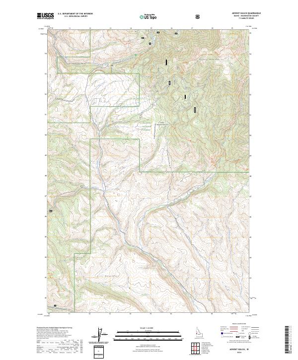
2024 Map of Advent Gulch
USGS Topo · Published 2024About this map
The Cuddy Mountains and Hitt Mountains dominate this high-altitude landscape within the Payette National Forest. This modern survey illustrates a network of specialized access, from the isolated Cuddy Meadows Airport to a complex system of forest roads and trails that follow the steep drainages of the region. Notable watercourses including Pine Creek, East Pine Creek, and Mill Creek carve through the terrain, providing the natural corridors for routes like the Mill Creek Trl and Advent Gulch Rd. The mapping of Advent Gulch and the Cracker Jack Creek Trl highlights the enduring importance of traditional backcountry access in these protected lands. This area remains a crucial intersection of wilderness management and light aviation, where the absence of dense settlement emphasizes the focus on recreation and resource protection.
Find a feature on this map
25 named features on this map. Tap any name to fly to it.
Don’t see what you’re looking for? This feature index may not catch every label — zoom into the map to look around manually.
Map Details
Editions of this 2024 Advent Gulch Map
This is the sole edition of this map. No revisions or reprints were ever made.
Other maps of this area

1955 · Baker
USGS Topo · 1:250,000

1957 · Cambridge
USGS Topo · 1:62,500

1957 · Copperfield
USGS Topo · 1:62,500

1957 · Hornet
USGS Topo · 1:62,500

1957 · Sturgill Peak
USGS Topo · 1:62,500

1959 · Baker
USGS Topo · 1:250,000

1980 · McCall
USGS Topo · 1:100,000
1986 · Crooked River Point
USGS Topo · 1:24,000
1986 · Cambridge
USGS Topo · 1:24,000
1986 · Rush Peak
USGS Topo · 1:24,000