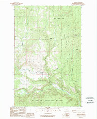
1988 Map of Aeneas
USGS Topo · Published 1988About this map
The West Fork Sanpoil River carves through this high-country landscape in the late 1980s, anchoring a network of remote ranching operations and mountain drainages. The small settlement of Aeneas sits near the river's path, while family-named holdings such as the Tratnick Ranch and C M Pardey Ranch are situated along the valleys of Ogle Creek and the Sanpoil fork. This quadrangle captures the land management patterns of the Okanogan National Forest, where topography is defined by prominent peaks like Coco Mountain and Cornell Butte. Resource extraction and land use are visible through markers for a Prospect and a Gravel Pit, while the presence of Gooseberry Meadow and numerous isolated springs, such as Russell Spring, indicates the scattered water sources critical for life in this part of Washington. The terrain is further dissected by several notable watercourses, including Lost Creek, Squaw Creek, and Deep Creek.
Find a feature on this map
19 named features on this map. Tap any name to fly to it.
Don’t see what you’re looking for? This feature index may not catch every label — zoom into the map to look around manually.
Map Details
Editions of this 1988 Aeneas Map
This is the sole edition of this map. No revisions or reprints were ever made.
Other maps of this area

1902 · Osoyoos
USGS Topo · 1:125,000

1904 · Osoyoos
USGS Topo · 1:125,000

1904 · Republic
USGS Topo · 1:125,000

1951 · Wauconda
USGS Topo · 1:62,500

1952 · Disautel
USGS Topo · 1:62,500

1953 · Bald Knob
USGS Topo · 1:62,500

1954 · Okanogan
USGS Topo · 1:250,000

1957 · Aeneas Valley
USGS Topo · 1:62,500

1958 · Okanogan
USGS Topo · 1:250,000

1958 · Aeneas
USGS Topo · 1:62,500