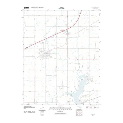
2010 Map of Afton
USGS Topo · Published 2010About this map
Afton serves as the focal point of this northeast Oklahoma survey, where a well-defined grid of residential streets meets a complex transportation network. The map reveals the area's transition from rural townships to developed lakeside communities near the Neosho River. The convergence of modern highway infrastructure at the Afton Interchange contrasts with the traditional rural layout, providing a look at how regional travel corridors have reshaped the landscape around the town center and nearby Oseuma.
Find a feature on this map
36 named features on this map. Tap any name to fly to it.
Don’t see what you’re looking for? This feature index may not catch every label — zoom into the map to look around manually.
Map Details
Editions of this 2010 Afton Map
This is the sole edition of this map. No revisions or reprints were ever made.
Other maps of this area

1901 · Vinita
USGS Topo · 1:125,000

1907 · Wyandotte
USGS Topo · 1:125,000

1909 · Wyandotte
USGS Topo · 1:125,000

1913 · Vinita
USGS Topo · 1:125,000

1954 · Tulsa
USGS Topo · 1:250,000

1958 · Tulsa
USGS Topo · 1:250,000

1961 · Miami SE
USGS Topo · 1:24,000

1961 · Miami SW
USGS Topo · 1:24,000

1963 · Tulsa
USGS Topo · 1:250,000
1971 · Grove
USGS Topo · 1:24,000