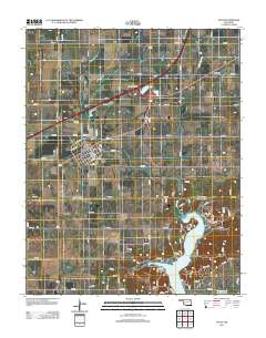
2012 Map of Afton
USGS Topo · Published 2012About this map
Afton stands as a central hub in this northeastern Oklahoma landscape, where the modern Afton Interchange links major transit routes above the town's established street grid. The topography is defined by the northern reaches of the Grand Lake O' the Cherokees, which branches into smaller waterways like Horse Cr and Fly Cr. This 2012 survey provides a clear view of the balance between recreational lakeside developments and the area's deep-rooted history.
Find a feature on this map
72 named features on this map. Tap any name to fly to it.
Don’t see what you’re looking for? This feature index may not catch every label — zoom into the map to look around manually.
Map Details
Editions of this 2012 Afton Map
This is the sole edition of this map. No revisions or reprints were ever made.
Other maps of this area

1901 · Vinita
USGS Topo · 1:125,000

1907 · Wyandotte
USGS Topo · 1:125,000

1909 · Wyandotte
USGS Topo · 1:125,000

1913 · Vinita
USGS Topo · 1:125,000

1954 · Tulsa
USGS Topo · 1:250,000

1958 · Tulsa
USGS Topo · 1:250,000

1961 · Miami SE
USGS Topo · 1:24,000

1961 · Miami SW
USGS Topo · 1:24,000

1963 · Tulsa
USGS Topo · 1:250,000
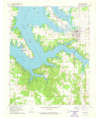
1971 · Grove
USGS Topo · 1:24,000