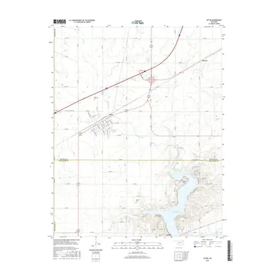
2016 Map of Afton
USGS Topo · Published 2016About this map
Afton stands as a primary crossroads in the northern reaches of the Grand Lake O' the Cherokees region, where interstate highways and local section roads meet. This landscape transitions from the agricultural plateaus of Ottawa Co into the intricate shoreline of Delaware Co to the south. Along the northern fingers of the lake, settlements like Bernice and Indian Hills occupy the peninsulas near Horse Creek Cove and Cedar Point.
Find a feature on this map
74 named features on this map. Tap any name to fly to it.
Don’t see what you’re looking for? This feature index may not catch every label — zoom into the map to look around manually.
Map Details
Editions of this 2016 Afton Map
This is the sole edition of this map. No revisions or reprints were ever made.
Other maps of this area

1901 · Vinita
USGS Topo · 1:125,000

1907 · Wyandotte
USGS Topo · 1:125,000

1909 · Wyandotte
USGS Topo · 1:125,000

1913 · Vinita
USGS Topo · 1:125,000

1954 · Tulsa
USGS Topo · 1:250,000

1958 · Tulsa
USGS Topo · 1:250,000

1961 · Miami SE
USGS Topo · 1:24,000

1961 · Miami SW
USGS Topo · 1:24,000

1963 · Tulsa
USGS Topo · 1:250,000
1971 · Grove
USGS Topo · 1:24,000