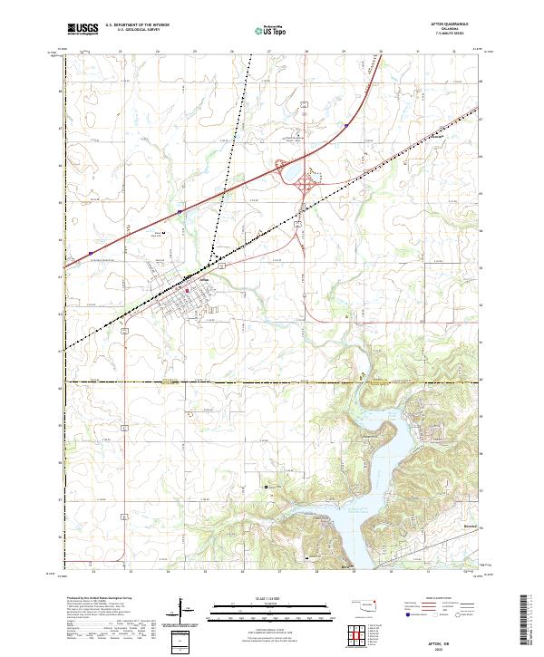
2022 Map of Afton
USGS Topo · Published 2022About this map
Afton serves as the central hub of this northeastern Oklahoma landscape, situated at a major transportation crossroads just north of the expansive Grand Lake O' The Cherokees. The map illustrates a transition from the structured street grid of the town to the complex, winding shorelines of the reservoir to the south. Along the water, communities like Indian Hills, Cedar Point, and Bernice highlight the area's development around the lake's inlets, such as Horse Creek Cove. For genealogists and local historians, several burial grounds are preserved across the townships, including Mount Hope Cem near the town center and the Sixkiller Cem and Ballard Cem further south. The drainage patterns of Horse Creek and Fly Creek define the rural stretches between these settlements, while the presence of the Northeast-Technology Center - Afton underscores the town's role as a regional anchor for education and industry in Ottawa and Delaware Counties.
Find a feature on this map
83 named features on this map. Tap any name to fly to it.
Don’t see what you’re looking for? This feature index may not catch every label — zoom into the map to look around manually.
Map Details
Editions of this 2022 Afton Map
This is the sole edition of this map. No revisions or reprints were ever made.
Other maps of this area

1901 · Vinita
USGS Topo · 1:125,000

1907 · Wyandotte
USGS Topo · 1:125,000

1909 · Wyandotte
USGS Topo · 1:125,000

1913 · Vinita
USGS Topo · 1:125,000

1954 · Tulsa
USGS Topo · 1:250,000

1958 · Tulsa
USGS Topo · 1:250,000

1961 · Miami SE
USGS Topo · 1:24,000

1961 · Miami SW
USGS Topo · 1:24,000

1963 · Tulsa
USGS Topo · 1:250,000
1971 · Grove
USGS Topo · 1:24,000