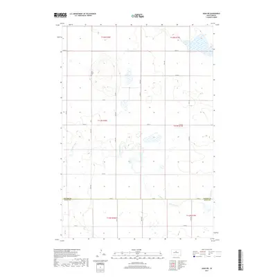
2017 Map of Agar NW
USGS Topo · Published 2017About this map
Petro Family Cem stands as a lonely historical marker within this expansive prairie landscape on the border of Potter County and Sully County. The terrain is defined by the winding course of Artichoke Creek, which meanders across the southern sections of the survey. The settlement pattern here is characterized by a sparse, geometric grid of rural routes, including 297 Ave and 300th Ave, reflecting the systematic township and range organization typical of the Great Plains. Most of the land remains open, punctuated by seasonal wetlands and the distinct drainage of Artichoke Cr as it flows toward the southwest. This study provides a clear view of the agricultural infrastructure of the late 2010s, showing the precise placement of section lines and local connectors like Co Rd 750.
Find a feature on this map
26 named features on this map. Tap any name to fly to it.
Don’t see what you’re looking for? This feature index may not catch every label — zoom into the map to look around manually.
Map Details
Editions of this 2017 Agar NW Map
This is the sole edition of this map. No revisions or reprints were ever made.
Other maps of this area

1953 · McIntosh
USGS Topo · 1:250,000

1954 · Pierre
USGS Topo · 1:250,000

1958 · Pierre
USGS Topo · 1:250,000

1958 · McIntosh
USGS Topo · 1:250,000

1965 · Artichoke Butte
USGS Topo · 1:24,000

1965 · Agar SW
USGS Topo · 1:24,000

1965 · Agar
USGS Topo · 1:24,000

1969 · Patch Skin Buttes SE
USGS Topo · 1:24,000

1970 · Lake Hurley
USGS Topo · 1:24,000

1970 · Agar NW
USGS Topo · 1:24,000