
1965 Map of Artichoke Butte
USGS Topo · Published 1966About this map
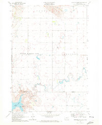
Artichoke Butte stands as a prominent landmark on this high plains landscape of Sully County, marking the transition from the rolling prairie down toward the waters of the Oahe Reservoir. In the mid-1960s, the Missouri River Basin development program shaped this region, with the reservoir waters creating an environment subject to controlled inundation. The map reveals the rural infrastructure of the era, where isolated education centers like Troy Sch served the surrounding ranching community near Troy Lake. A network of section lines and fence lines reveals the systematic division of the land into the large parcels characteristic of central South Dakota. This sheet documents the post-dam landscape at a time when the impact of the reservoir was relatively new, providing a clear view of the topography before further modern changes to the shoreline and local farmsteads occurred.
Find a feature on this map
5 named features on this map. Tap any name to fly to it.
Don’t see what you’re looking for? This feature index may not catch every label — zoom into the map to look around manually.
Map Details
Editions of this 1965 Artichoke Butte Map
This is the sole edition of this map. No revisions or reprints were ever made.
Other maps of this area

1954 · Pierre
USGS Topo · 1:250,000

1958 · Pierre
USGS Topo · 1:250,000

1965 · Agar SW
USGS Topo · 1:24,000

1965 · Okobojo NE
USGS Topo · 1:24,000

1965 · Artichoke Butte SW
USGS Topo · 1:24,000

1965 · Okobojo
USGS Topo · 1:24,000

1965 · Sully Lake
USGS Topo · 1:24,000

1969 · Artichoke Butte NW
USGS Topo · 1:24,000

1970 · Agar NW
USGS Topo · 1:24,000
1970 · Artichoke Butte NE
USGS Topo · 1:24,000