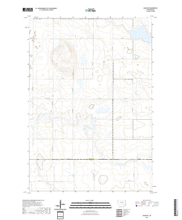
2021 Map of Agar NW
USGS Topo · Published 2021About this map
Artichoke Creek winds through this section of the Missouri Plateau, defining the drainage patterns across the northern edge of the Sully and Potter county line. The landscape is characterized by its systematic section-line road network, including routes like Co Rd 750 and Co Rd 816, which provide access across the largely open prairie. The topography is defined by subtle depressions and rises, with numerous small basins and wetlands scattered throughout the northern sections of the survey.
Find a feature on this map
26 named features on this map. Tap any name to fly to it.
Don’t see what you’re looking for? This feature index may not catch every label — zoom into the map to look around manually.
Map Details
Editions of this 2021 Agar NW Map
This is the sole edition of this map. No revisions or reprints were ever made.
Other maps of this area

1953 · McIntosh
USGS Topo · 1:250,000

1954 · Pierre
USGS Topo · 1:250,000

1958 · Pierre
USGS Topo · 1:250,000

1958 · McIntosh
USGS Topo · 1:250,000

1965 · Artichoke Butte
USGS Topo · 1:24,000

1965 · Agar SW
USGS Topo · 1:24,000

1965 · Agar
USGS Topo · 1:24,000

1969 · Patch Skin Buttes SE
USGS Topo · 1:24,000

1970 · Lake Hurley
USGS Topo · 1:24,000

1970 · Agar NW
USGS Topo · 1:24,000