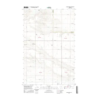
2017 Map of Agawam North
USGS Topo · Published 2017About this map
The unincorporated settlement of Agawam sits near the southern boundary of this survey, a point of interest for those tracking the high plains of north-central Montana. The landscape is defined by the stark transition between the elevated Porter Bench and the intricate network of seasonal drainage channels, or coulees, that carve through the prairie. Water management is a primary feature of the region's agricultural footprint, evidenced by the presence of the Bynum Canal and C Canal, which divert resources across the Teton and Pondera county lines. These man-made waterways contrast with natural features like Pondera Coulee in the north and the multi-branched Farmers Coulee to the south. The road network follows the rigid Public Land Survey System grid, with named routes like Black Gold Rd and Oil Field Rd suggesting the local intersection of ranching and energy extraction.
Find a feature on this map
34 named features on this map. Tap any name to fly to it.
Don’t see what you’re looking for? This feature index may not catch every label — zoom into the map to look around manually.
Map Details
Editions of this 2017 Agawam North Map
This is the sole edition of this map. No revisions or reprints were ever made.
Other maps of this area

1920 · Choteau
USGS Topo · 1:125,000

1920 · Dupuyer
USGS Topo · 1:125,000

1936 · Pendroy
USGS Topo · 1:48,000

1938 · Gallup City
USGS Topo · 1:62,500

1941 · Pendroy
USGS Topo · 1:62,500

1942 · Gallup City
USGS Topo · 1:62,500

1955 · Choteau
USGS Topo · 1:250,000

1957 · Choteau
USGS Topo · 1:250,000

1958 · Choteau
USGS Topo · 1:250,000

1960 · Bynum
USGS Topo · 1:62,500