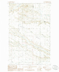
1985 Map of Agawam North
USGS Topo · Published 1986About this map
Agawam sits at the southern edge of this mid-1980s provisional study, a landscape defined by an extensive network of water management and resource extraction across the border of Teton and Pondera counties. The terrain is deeply incised by various drainages including Pondera Coulee, Porter Coulee, and Farmers Coulee, which cut through the high Bench land. This period shows a mature irrigation system dominated by the Bynum Canal, which winds through the southern sections to support local agriculture.
Find a feature on this map
14 named features on this map. Tap any name to fly to it.
Don’t see what you’re looking for? This feature index may not catch every label — zoom into the map to look around manually.
Map Details
Editions of this 1985 Agawam North Map
This is the sole edition of this map. No revisions or reprints were ever made.
Other maps of this area

1920 · Choteau
USGS Topo · 1:125,000

1920 · Dupuyer
USGS Topo · 1:125,000

1936 · Pendroy
USGS Topo · 1:48,000

1938 · Gallup City
USGS Topo · 1:62,500

1941 · Pendroy
USGS Topo · 1:62,500

1942 · Gallup City
USGS Topo · 1:62,500

1955 · Choteau
USGS Topo · 1:250,000

1957 · Choteau
USGS Topo · 1:250,000

1958 · Choteau
USGS Topo · 1:250,000

1960 · Bynum
USGS Topo · 1:62,500