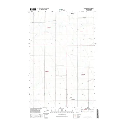
2014 Map of Agawam South
USGS Topo · Published 2014About this map
Farmington and Agawam anchor this Teton County landscape, where the high prairie begins its transition toward Burton Bench. The map records a grid-based rural settlement pattern, defined by precise section lines and long-established routes like 19th Rd NW and 20th Rd NW. Local water systems including Muddy Cr, Foster Cr, and Jones Cr snake through the terrain, their winding paths contrasting with the rigid geometry of the surrounding ranch and farm plots. Near the southern edge, Glendora Lake provides a notable hydrologic feature in an otherwise semi-arid environment. The small settlement of Malone sits centrally, illustrating the sparse but deliberate distribution of communities across the Montana plains during the early twenty-first century.
Find a feature on this map
26 named features on this map. Tap any name to fly to it.
Don’t see what you’re looking for? This feature index may not catch every label — zoom into the map to look around manually.
Map Details
Editions of this 2014 Agawam South Map
This is the sole edition of this map. No revisions or reprints were ever made.
Other maps of this area

1920 · Choteau
USGS Topo · 1:125,000

1920 · Dupuyer
USGS Topo · 1:125,000

1936 · Pendroy
USGS Topo · 1:48,000

1938 · Gallup City
USGS Topo · 1:62,500

1941 · Pendroy
USGS Topo · 1:62,500

1942 · Gallup City
USGS Topo · 1:62,500

1955 · Choteau
USGS Topo · 1:250,000

1957 · Choteau
USGS Topo · 1:250,000

1958 · Choteau
USGS Topo · 1:250,000

1960 · Bynum
USGS Topo · 1:62,500