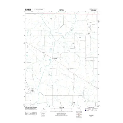
2012 Map of Agency
USGS Topo · Published 2012About this map
The Platte River snakes through the center of this Buchanan County landscape, serving as the primary drainage for numerous tributaries like Candy Creek, Riley Branch, and Third Fork. The agricultural character of the region is punctuated by small clusters of settlement at Easton, Evansville, and Garrettsburg, where the road network transitions from paved routes to localized gravel tracks such as Se 85th RD and Se Delwood DR.
Find a feature on this map
72 named features on this map. Tap any name to fly to it.
Don’t see what you’re looking for? This feature index may not catch every label — zoom into the map to look around manually.
Map Details
Editions of this 2012 Agency Map
This is the sole edition of this map. No revisions or reprints were ever made.
Other maps of this area

1923 · Clarksdale
USGS Topo · 1:62,500

1924 · St. Joseph
USGS Topo · 1:62,500

1925 · Gower
USGS Topo · 1:62,500

1925 · Clarksdale
USGS Topo · 1:62,500

1926 · Saint Joseph
USGS Topo · 1:62,500

1927 · Dearborn
USGS Topo · 1:62,500

1950 · Kansas City
USGS Topo · 1:250,000

1951 · Edgerton
USGS Topo · 1:24,000
1951 · Gower
USGS Topo · 1:24,000
1951 · Dearborn
USGS Topo · 1:24,000