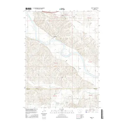
2015 Map of Agency
USGS Topo · Published 2015About this map
The Des Moines River winds through the heart of this landscape, carving a wide valley between Agency and the crossing at Cliffland. This 2015 study by the U.S. Geological Survey details a region defined by its rural heritage and early burial grounds. Significant local landmarks include the Chief Wapello Cem and the Hackney Grave, which provide tangible connections to the area's 19th-century residents. The terrain is deeply etched by tributaries such as Village Cr, Chippewa Cr, and Little Soap Cr, creating a series of ridges that host numerous family and pioneer cemeteries. From the Mars Hill Cem near the southern boundary to the Railback Cem overlooking the river, these sites offer valuable data for genealogists tracing families in the borderlands of Wapello and Davis counties.
Find a feature on this map
59 named features on this map. Tap any name to fly to it.
Don’t see what you’re looking for? This feature index may not catch every label — zoom into the map to look around manually.
Map Details
Editions of this 2015 Agency Map
This is the sole edition of this map. No revisions or reprints were ever made.
Other maps of this area

1954 · Centerville
USGS Topo · 1:250,000

1954 · Des Moines
USGS Topo · 1:250,000

1956 · Des Moines
USGS Topo · 1:250,000

1956 · Farson
USGS Topo · 1:24,000

1956 · Agency
USGS Topo · 1:24,000

1956 · Ottumwa North
USGS Topo · 1:62,500

1956 · Ottumwa South
USGS Topo · 1:24,000

1956 · Ottumwa South
USGS Topo · 1:62,500

1956 · Ottumwa North
USGS Topo · 1:24,000

1957 · Des Moines
USGS Topo · 1:250,000