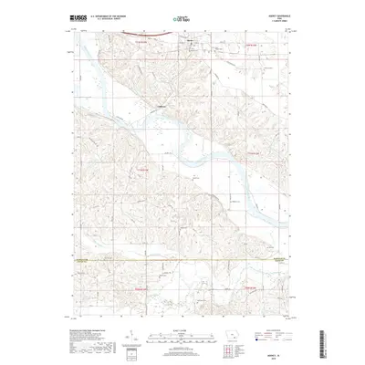
2018 Map of Agency
USGS Topo · Published 2018About this map
The Des Moines River winds through the heart of this southeastern Iowa landscape, cutting deep meanders through the hills of Wapello and Davis counties. The town of Agency sits on the higher ground north of the river, anchored by its post office and the heavy rail traffic of the BNSF Railway. This area is notable for its concentration of small, family-named burial sites and landmarks that speak to the long-standing agricultural roots of the community. Among these is the Chief Wapello Cem, which honors the Meskwaki leader for whom the county was named. South of the river, the terrain becomes increasingly dissected by tributaries like Little Soap Cr and Soap Creek, where the road network tightens around the winding topography. Settlements like Cliffland provide a link to the riverside history of the region, while numerous rural cemeteries such as Mars Hill Cem and Hackney Grave offer vital points of interest for genealogists tracing early families.
Find a feature on this map
75 named features on this map. Tap any name to fly to it.
Don’t see what you’re looking for? This feature index may not catch every label — zoom into the map to look around manually.
Map Details
Editions of this 2018 Agency Map
This is the sole edition of this map. No revisions or reprints were ever made.
Other maps of this area

1954 · Centerville
USGS Topo · 1:250,000

1954 · Des Moines
USGS Topo · 1:250,000

1956 · Des Moines
USGS Topo · 1:250,000

1956 · Farson
USGS Topo · 1:24,000

1956 · Agency
USGS Topo · 1:24,000

1956 · Ottumwa North
USGS Topo · 1:62,500

1956 · Ottumwa South
USGS Topo · 1:24,000

1956 · Ottumwa South
USGS Topo · 1:62,500

1956 · Ottumwa North
USGS Topo · 1:24,000

1957 · Des Moines
USGS Topo · 1:250,000