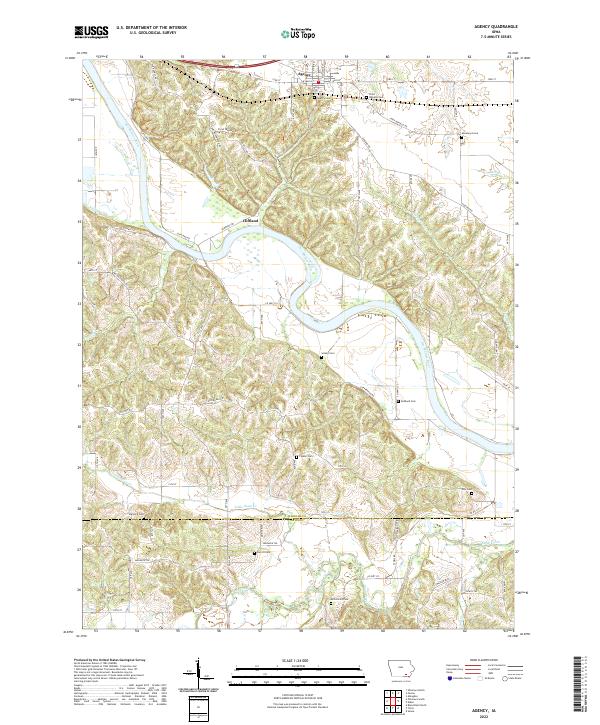
2022 Map of Agency
USGS Topo · Published 2022About this map
The Des Moines River carves a deep, winding path through this portion of southeast Iowa, anchoring the settlement of Agency and the smaller community of Cliffland. This landscape is particularly significant for its concentrated historical burial sites and memorial landmarks. Genealogists can find numerous family and community resting places, including the Agency Cem, Railback Cem, and the lone Hackney Grave north of the river. The southern edge of the map follows the Wapello Co Davis Co line, where the terrain shifts toward the drainage basins of Little Soap Cr and Soap Creek. Significant local markers like the Chief Wapello Cem and Mars Hill Cem reflect the long history of residency and honor in the region. The map also delineates a network of rural routes such as Old Agency Rd and Chief Wapello Rd, which trace the historical movement of people across the river bluffs.
Find a feature on this map
53 named features on this map. Tap any name to fly to it.
Don’t see what you’re looking for? This feature index may not catch every label — zoom into the map to look around manually.
Map Details
Editions of this 2022 Agency Map
This is the sole edition of this map. No revisions or reprints were ever made.
Other maps of this area

1954 · Centerville
USGS Topo · 1:250,000

1954 · Des Moines
USGS Topo · 1:250,000

1956 · Des Moines
USGS Topo · 1:250,000

1956 · Farson
USGS Topo · 1:24,000

1956 · Agency
USGS Topo · 1:24,000

1956 · Ottumwa North
USGS Topo · 1:62,500

1956 · Ottumwa South
USGS Topo · 1:24,000

1956 · Ottumwa South
USGS Topo · 1:62,500

1956 · Ottumwa North
USGS Topo · 1:24,000

1957 · Des Moines
USGS Topo · 1:250,000