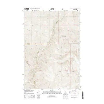
2013 Map of Aggipah Mountain
USGS Topo · Published 2013About this map
The Middle Fork Salmon River carves a deep path through this wilderness landscape, serving as the primary geographic axis where Idaho and Lemhi counties meet. At higher elevations, the Stoddard Creek Lookout and Aggipah Mtn provide vantage points over a complex drainage system fed by Stoddard Cr, Cradle Cr, and Ship Island Cr. This 2013 survey illustrates the intersection of the Salmon National Forest and Payette National Forest, highlighting the remote recreational infrastructure found at the Lightning Strike Campground and Papoose Creek Campground. The river's character is defined by a series of named navigational hazards, including Otzel Rapids, Outside Rapids, and Redside Rapids, which indicate the steep, technical nature of this waterway. Inland, high-altitude water bodies like Ship Island Lake sit tucked away in the steep terrain near Aggipah Mtn.
Find a feature on this map
26 named features on this map. Tap any name to fly to it.
Don’t see what you’re looking for? This feature index may not catch every label — zoom into the map to look around manually.
Map Details
Editions of this 2013 Aggipah Mountain Map
This is the sole edition of this map. No revisions or reprints were ever made.
Other maps of this area

1956 · Elk City
USGS Topo · 1:250,000

1960 · Elk City
USGS Topo · 1:250,000

1962 · Hoodoo Meadows
USGS Topo · 1:24,000

1962 · Long Tom Mtn
USGS Topo · 1:24,000

1962 · Puddin Mtn
USGS Topo · 1:24,000

1962 · Papoose Peak
USGS Topo · 1:24,000

1962 · Aggipah Mtn
USGS Topo · 1:24,000

1962 · Mt Mc Guire
USGS Topo · 1:24,000

1962 · Dave Lewis Peak
USGS Topo · 1:24,000

1962 · Butts Creek Point
USGS Topo · 1:24,000