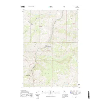
2020 Map of Aggipah Mountain
USGS Topo · Published 2020About this map
The Middle Fork Salmon Wild and Scenic River bisects this wilderness landscape, carving a deep corridor through the Salmon National Forest and Payette National Forest. This 2020 survey documents the intersection of three major Idaho counties—Lemhi, Valley, and Idaho—converging amidst the high elevations of the Salmon River Mountains. Notable landmarks include the prominent Aggipah Mtn and Ship Island, while high-alpine water features like Stoddard Lake feed a network of drainages including Stoddard Cr and Ship Island Cr. The presence of a named Waterfall near Waterfall Cr in the southern reaches highlights the steep vertical drops characteristic of this river system, which remains one of the most protected free-flowing waterways in the region.
Find a feature on this map
28 named features on this map. Tap any name to fly to it.
Don’t see what you’re looking for? This feature index may not catch every label — zoom into the map to look around manually.
Map Details
Editions of this 2020 Aggipah Mountain Map
This is the sole edition of this map. No revisions or reprints were ever made.
Other maps of this area

1956 · Elk City
USGS Topo · 1:250,000

1960 · Elk City
USGS Topo · 1:250,000

1962 · Hoodoo Meadows
USGS Topo · 1:24,000

1962 · Long Tom Mtn
USGS Topo · 1:24,000

1962 · Puddin Mtn
USGS Topo · 1:24,000

1962 · Papoose Peak
USGS Topo · 1:24,000

1962 · Aggipah Mtn
USGS Topo · 1:24,000

1962 · Mt Mc Guire
USGS Topo · 1:24,000

1962 · Dave Lewis Peak
USGS Topo · 1:24,000

1962 · Butts Creek Point
USGS Topo · 1:24,000