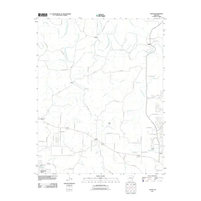
2011 Map of Agnos
USGS Topo · Published 2011About this map
Agnos and Glencoe anchor the central and western reaches of this North Arkansas landscape, where the South Fork Spring River and its numerous tributaries like Wild Horse Creek define the local topography. This 2011 survey illustrates a region characterized by a network of rural county roads, such as Quilt Palace Rd and Fernwood Rd, which connect small settlements and family-named landmarks. For genealogists, the map identifies specific burial grounds including Rhoads Cemetery near the Highway 62 corridor and Humphries Cemetery further south. The drainage patterns of the Ozark foothills are clearly visible, punctuated by water management features like the Lake Brown Dam and Timber Lake Dam, alongside the residential growth appearing near the outskirts of Horseshoe Bend and the developing street patterns around Kittle.
Find a feature on this map
73 named features on this map. Tap any name to fly to it.
Don’t see what you’re looking for? This feature index may not catch every label — zoom into the map to look around manually.
Map Details
Editions of this 2011 Agnos Map
This is the sole edition of this map. No revisions or reprints were ever made.
Other maps of this area

1950 · Salem
USGS Topo · 1:62,500

1951 · Salem
USGS Topo · 1:62,500

1951 · Melbourne
USGS Topo · 1:62,500

1957 · Poplar Bluff
USGS Topo · 1:250,000

1959 · Poplar Bluff
USGS Topo · 1:250,000

1960 · Poplar Bluff
USGS Topo · 1:250,000

1962 · Stuart
USGS Topo · 1:24,000

1962 · Ash Flat
USGS Topo · 1:24,000

1962 · Myron
USGS Topo · 1:24,000

1962 · Agnos
USGS Topo · 1:24,000