
1962 Map of Myron
USGS Topo · Published 1963About this map
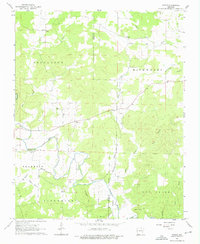
The Strawberry River meanders through the heart of the Ozark foothills, defining the rural character of this northern Arkansas landscape in the early 1960s. Small, dispersed settlements like Myron and Ballard serve as local anchors for a community deeply rooted in the land. The map reveals a high density of family and community burial grounds, including the Bates Cem, Godwin Cem, and Hills Chapel Cem, which reflect the generations of residents who established farms and homesteads across the townships of Jefferson and Richwoods.
Find a feature on this map
35 named features on this map. Tap any name to fly to it.
Don’t see what you’re looking for? This feature index may not catch every label — zoom into the map to look around manually.
Map Details
Editions of this 1962 Myron Map
3 editions found
Other maps of this area

1950 · Salem
USGS Topo · 1:62,500

1951 · Salem
USGS Topo · 1:62,500

1951 · Melbourne
USGS Topo · 1:62,500

1957 · Poplar Bluff
USGS Topo · 1:250,000

1959 · Poplar Bluff
USGS Topo · 1:250,000

1960 · Poplar Bluff
USGS Topo · 1:250,000
1961 · Evening Shade
USGS Topo · 1:24,000

1962 · Stuart
USGS Topo · 1:24,000

1962 · Ash Flat
USGS Topo · 1:24,000
1962 · Sidney
USGS Topo · 1:24,000